A recent trip through Hong Kong had a long layover between flights. After a long trip from the US, I decided to get some fresh air by hiking Lantau Island. Advice from friends and googling helped me sketch out a plan, although my route was much different from intended. That’s not to say it wasn’t pleasant, and happily I’d do it again.
How to get from Hong Kong Airport to the hiking trails
Just as a reminder, the airport (Chek Lap Kok) is on reclaimed land attached to Lantau Island, to the west of Hong Kong Island. Lantau is the largest island in Hong Kong, and although it is developing, with Disneyland, Big Buddha, and housing in Tung Chung, there are still a lot of natural areas to enjoy. And prisons. Over 50% of the island is national park land. There is hiking trails all over the island, and being near the airport, travelers on a layover can get out for a hike pretty easily.
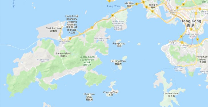
There are frequent buses from the Ground Transportation Centre to various places in Lantau. Since I wanted to change clothes and store my laptop bag, I took a bus to Tung Chung. I just used Google maps transit directions, but the MTR app is likely even better. Walked to the Ground Transportation Centre, waited a few minutes, and hopped on a bus that routed around Chek Lap Kok, including Cathay City (airline headquarters).
Bus to Tung Chung
Public transportation in Hong Kong is cheap and easy, and I just used my octopus card. Once on the bus, several stops, maybe 10-12 minutes later I got off near the Tung Chung MTR station. From there, I walked to Citygate Outlets, a shopping mall connected to the MTR station, and there are cheap lockers for rent. I found this a better option than held luggage at the airport, mostly for cost. But when I returned to collect my bag, there was a queue waiting for a free locker.
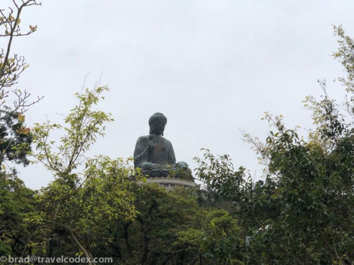
In Tung Chung, besides the mall, there is easy access to the cable car that goes to the top of Ngong Ping, and the giant Buddha statue up there. Scott talked about visiting there in a previous post. There are even some hiking/walking options directly from there. For those that ride the cable car, there is a hiking trail that follows the path for much of the route. I didn’t hike this trail, but maybe I will on a future trip.
Bus from Tung Chung to Trailhead
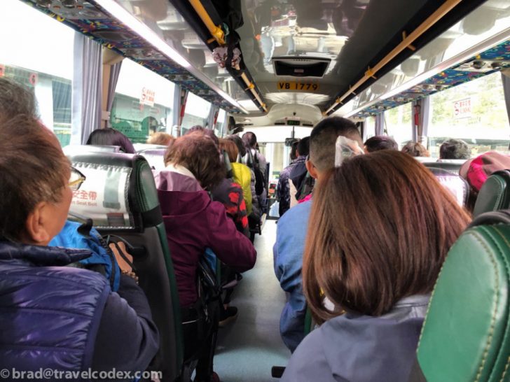
There are trails all over the island. I went into this with a planned route, (linked here, suggested by a friend) but actually ended up doing a completely different trail. It worked out fine, but now I have something for a future trip. As noted in the post linked above, I took a bus from Tung Chung (bus 11, I believe) intending to pick up the trail at Pak Kung Au.
While waiting in the short queue for my bus, the person checking tickets gestured to me and held one finger up, I nodded and she waved me onto the bus. I don’t speak a word of Cantonese, but body language works…There were a bunch of people waiting ahead of me, but apparently no singles, so I cut the line. The last open seat on the bus full of mostly older folks dressed for outdoor activity in the cool February air. Well, cool temperatures for Hong Kong. I was wearing shorts…
Wait, which trailhead?
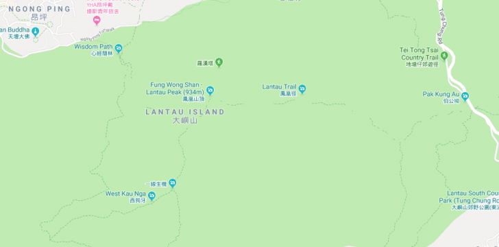
I wasn’t positive where I was stopping, but according to Google, my destination was a few stops away. Going with the flow was my plan. The bus started rolling, and I was trying to track progress on my phone, but we kept moving, and never stopped at any of the early stops along the route. I missed the opportunity to request a stop at Pak Kung Au, and the bus kept going. It went further than intended, eventually stopping at a park on the south side of Lantau. A few people got off, and I jumped up and joined them. I was considering finding another bus going the other way and trying again, but after some quick searching I found another route near where I was. It would also end up near the Big Buddha, as I originally planned, so I decided to just go from here.
In hindsight, I should have asked the driver or some passengers about finding my intended destination. The trail head was not very well marked from the road, certainly not easy to spot when on a bus moving pretty quickly.
Hiking Lantau Island – Plan B
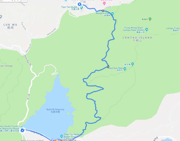
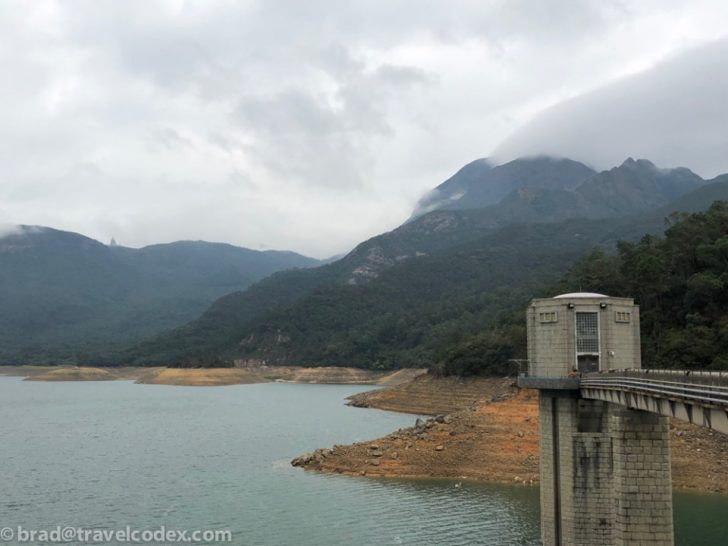
This wasn’t the route I was planning on, but it was nice, and other than a few people lingering around the trailhead, and then some folks coming down from Ngong Ping as I approached the end, I had the trail to myself. The first part was just on a sidewalk along the road the bus drive on near the reservoir.
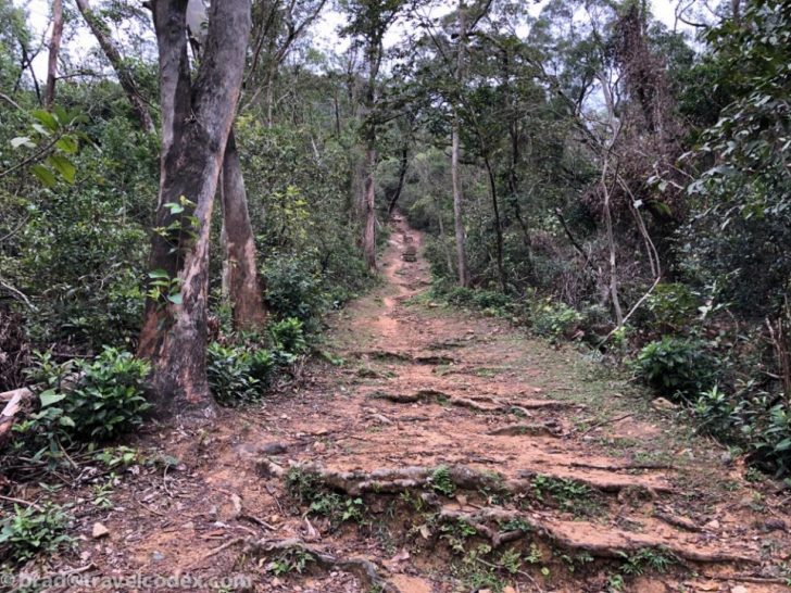
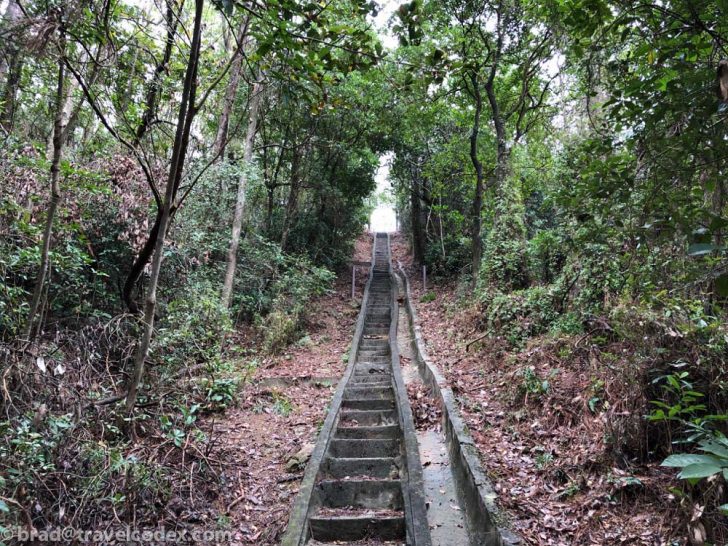
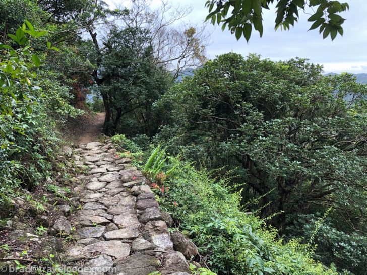
Once at the trailhead, there was a map, which I appreciated to confirm the trail info I found searching last-minute. With the confidence in my (new) plan, I headed off. I do hike fast, and despite a lot of gradual uphill climbing, and some stairs, I didn’t think this trail was too strenuous. I wore my running attire at had packed; shorts, running shoes, and a light jacket, mostly to protect against wind. The trail is smooth, and ankle support isn’t really needed other than some rocky areas including creek beds.
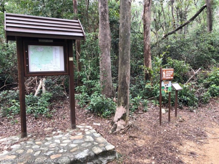
Hiking Lantau Island – The Shek Pik Country Trail
The trail is well maintained, and easy to follow. Any junctions are clearly marked, and there are signposts along the way for safety reasons. I didn’t look at my phone very much, but when I did, there was at least some mobile network coverage. Mostly just used it for photos.
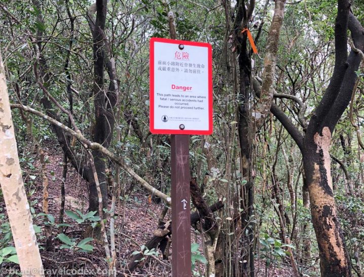
This junction was closed, I believe it is the first option on my marked route above, the easternmost point of the journey. I could have gone this was trying to get on to the route I originally planned on, but in interest of time, and to not walk on a closed trail, I kept on the path I was on.
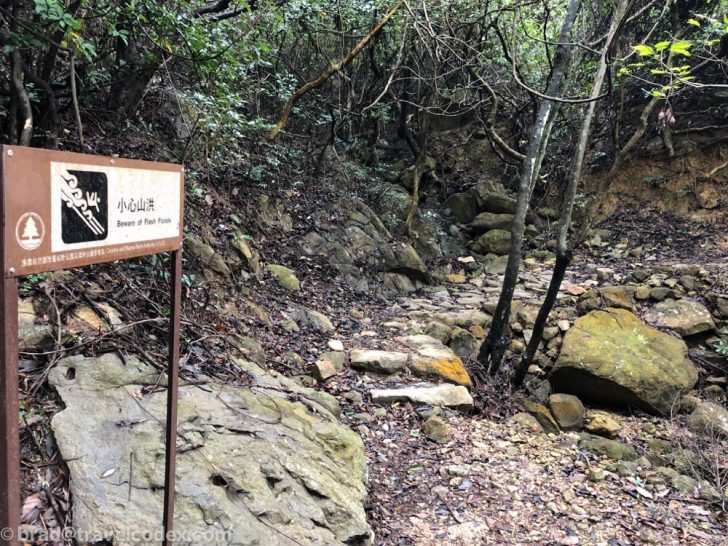
Steeper sections had stairs, plus a few areas where there are creek beds with warnings about flash flooding. On the day of my visit, it had rained in the morning, so there were some wet/muddy areas in low spots, but I easily avoided them. The trail was mostly dry.
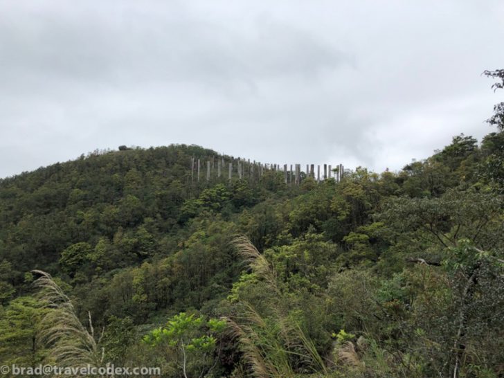
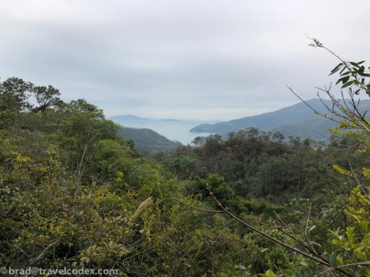
Some views looking back towards my starting point, the Shek Pik Reservoir:
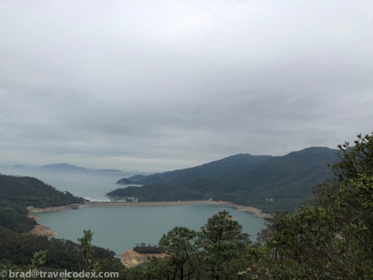
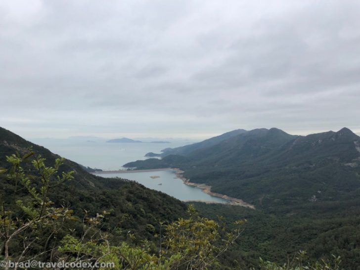
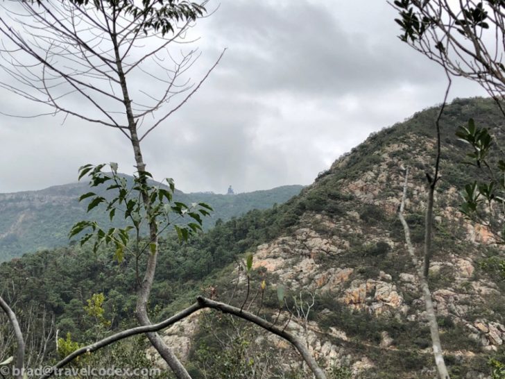
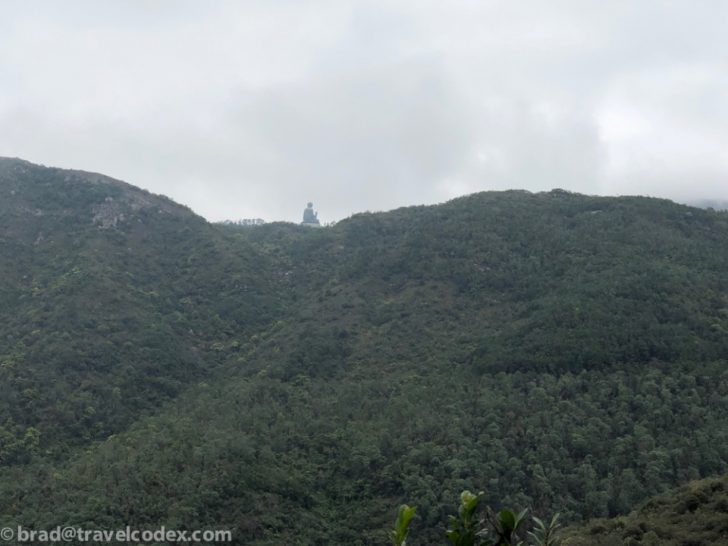
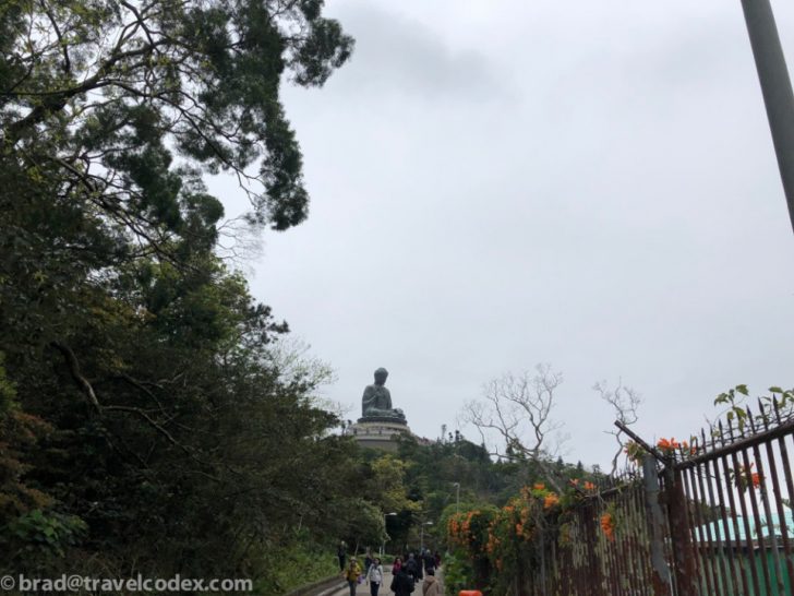
I used the lake as my reference point for where I started. Big Buddha in the distance as reference for my end point. The statue would occasionally be obscured by clouds, or sometimes trees or terrain.
Another dry creek bed crossing. On rainy days, I’m sure this would be more daunting to cross. 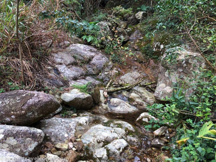
Made it to Ngong Ping
About 90 minutes after I started, I was in Ngong Ping. For the first hour plus, I was alone on the trail. I started to hear noise, and some trail runners were the first to approach me heading in the opposite direction. As I got closer to the end, a few more casual hikers were on the trail. Once in Ngong Ping, it was busy as ever with tourists visiting. The last time I was here it was driving rain, so it was nice to be dry this time. With more time to spare, I considered taking the cable car down. Instead I caught a bus that would take me back to Tung Chung, so I just hopped on. Faster, much cheaper, albeit less scenic than the cable car ride.
I opted to get out of such a touristy area and head into more central areas for lunch and more exploring. A more traditional tour of Hong Kong that I do often, and always enjoy. I took the MTR to Mong Kok, and explored a bit before returning to the airport.
How much time do I need for Hiking Lantau Island?
I’d say a minimum of 5 hours to do this comfortable. My layover was double that. I wasted time in transit and changing and storing my roller bag and other items I didn’t want on my hike. If in more of a rush, a taxi or Uber directly to a trailhead would certainly be quicker. Especially avoiding the uncertainty of how to get to my intended trailhead would help. If you haven’t already, be sure to sign up for E-Channel to expedite customs formalities when in Hong Kong. That can save time on arrival and departure from Hong Kong. There are shorter and less strenuous trails available as well. I’m by no means an expert on hiking in the area, but I’m happy to help guide you if you have questions.
My 5 hours suggestion is roughly based on this. Admittedly I cut it close at airport more often that I should, but returning to the airport at least 90 minutes before departure, plus an hour of transit time, 2 hours to hike, that’s 4.5 hours right there. I encourage you to get out and hike, but don’t miss your flight!
Final Thoughts on Hiking Lantau Island
Exercise is an important part of my travel routine. I like airports more than most people, but even with a layover at one of my favorites, and the many excellent Cathay Pacific lounges, it is nice to get out and move. Hiking Lantau Island was a great way to spend a few hours on a layover. I got a nice hike in, and still had time for some noodles and more in Hong Kong.
For a future trip, I’d still like to try out part of the Lantau Trail, and get to the summit of Lantau Peak. On the return bus journey, I attempted to spot the Pak Kung Au stop, and I think I saw it, but a little better advance planning, and maybe a word to the bus driver in advance would help.
Have you hiked in Hong Kong? Any favorite routes?