This is not your average blog post. This is a very long post about finding adventure in your own backyard and why sometimes you don’t need to go to the airport to explore someplace new. But I had a lot of fun on this trip, and I hope you enjoy the story.
Background
I’ve lived in Seattle for almost nine years, moving here in September 2007 to begin a Ph.D. program at the University of Washington. I hated the first two years. My thought was that Seattle would offer more variable weather than southern California — and it has — but the lack of sunlight really screwed with my psyche. I doesn’t rain all the time in Seattle like some people think. When it does it’s usually more of a spittle. But it is very cloudy and very dark, so it rarely dries out.
Over time I came to appreciate what made Seattle unique from the cookie cutter monotony of California. The mistrust of national chain stores. The drivers who actually obey the speed limit. The pirate riding a unicycle with a cat on his shoulder. Etcetera. And there’s a culture around food and beer that really encourages you to stay indoors.
But what first caught my attention were the streets. Despite “seven hills” and a variety of lakes and bays, most streets follow a very strict grid. If you go out to nearby suburbs you will find the numbers keep climbing into the 200s and higher. But not every street has a number. Some of them have names. This post is about one very special street that many have overlooked: Galer Street.
If you’ve driven through Seattle you probably passed Galer Street a few times, perhaps even spent a lot of time on it — it’s one of the major streets in Queen Anne. But in other places it dwindles to nothing. Sometimes it disappears altogether. This is not unique. Many streets preserve their names despite frequent interruptions. Galer just seems to get a lot more shit than others. After looking at it on a map, I realized it was actually pretty cool and passed by several important landmarks in Seattle.
The Plan
So one morning my wife and I resolved to walk the entire length of Galer St. We would start in upscale Madison Park in the west, travel up and down three hills and across Lake Union, and finish in an industrial area called Interbay.
The entire trip took four hours, including rest stops for food and drink. I do not recommend you take the exact route we did, especially most of the trails that went off road, but it’s still a great alternative to the usual boring Seattle attractions like the Space Needle and Pike Place Market. Locals don’t go to those places, especially not when a cruise ship is in port. If you want a local experience, go to Galer St.
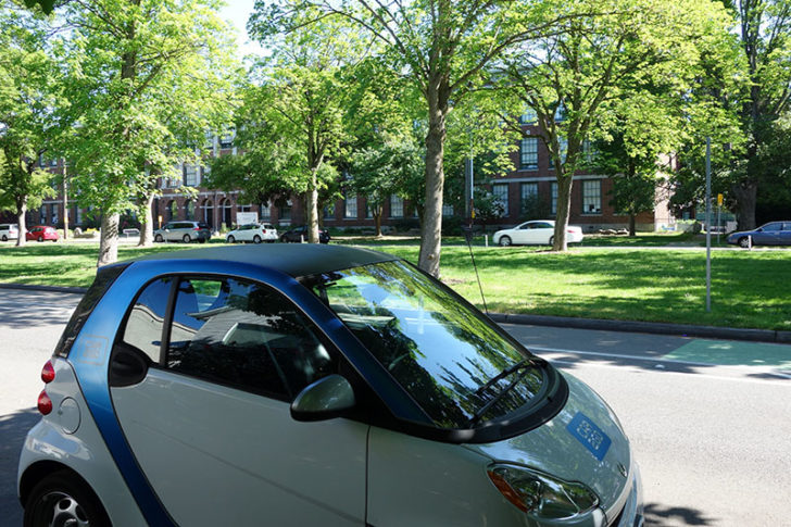
We live in Seattle’s Green Lake neighborhood and don’t own a car, so I walked down the block to find a Car2Go. These two-seaters are scattered throughout the city and let you pay about 40 cents a minute to drive from A to B, wherever and whenever you want. Unlike ZipCar you don’t have to return it when you’re done. Parking is free. There’s an app to help you find one nearby, and you can even reserve it in advance if you want (I rarely bother).
It is the perfect vehicle for a one-way trip like this one. While we walked most of the way, you could pick up a new Car2Go every time the road stopped and take it to the next point.
Car2Go is located in other cities, too, and I suggest you sign up before you arrive in Seattle. Take the light rail to your hotel downtown and skip the $40 overnight parking. Car2Go and the bus will get you almost everywhere. I don’t even use Uber in Seattle unless I’ve been out drinking.
Madison Park
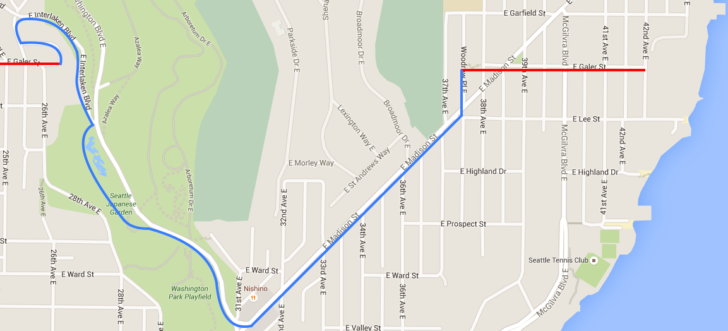
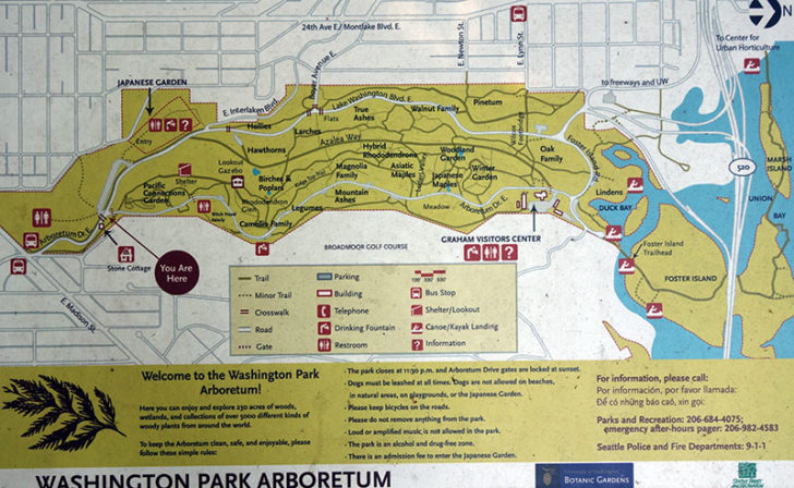
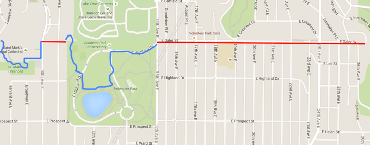
I’ll provide maps throughout this post. Red shows the portions we walked on Galer St. Blue shoes the portions we walked off Galer St.
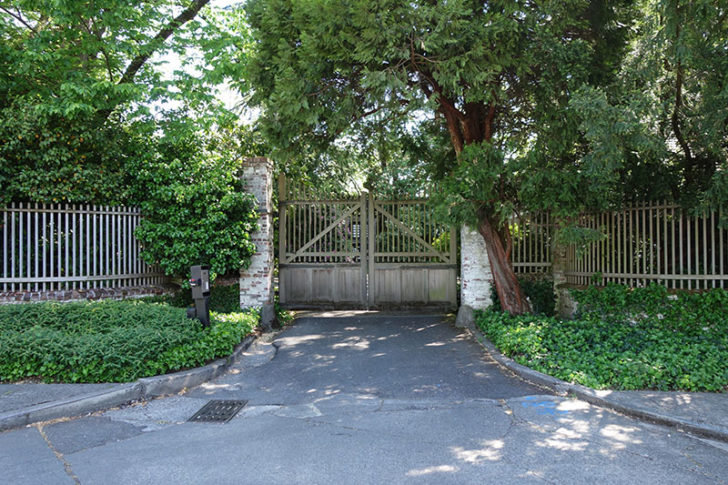
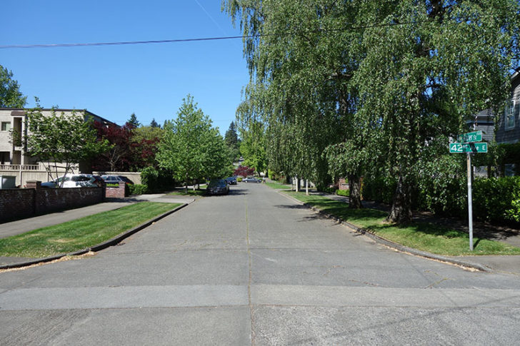
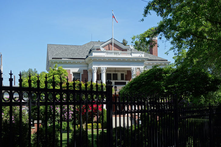
Dropping off the car at E Galer St. and 42nd Ave E, we found the gate to an enormous estate. There are still a few old houses on the other side of town in Queen Anne that fill an entire city block, but this looked bigger. To this day I have not been able to figure out who owns it.
Our curiosity still unsatisfied, we turned around and looked out to the road ahead of us.
Madison Park is an upscale neighborhood, and it has a great beach to visit in the summer if you want to cool off and Lake Washington warms up. (Puget Sound, on the other hand, is ice cold year round.) But I really like that it hasn’t been overgrown with new development. Lots of older, well maintained houses still exist.
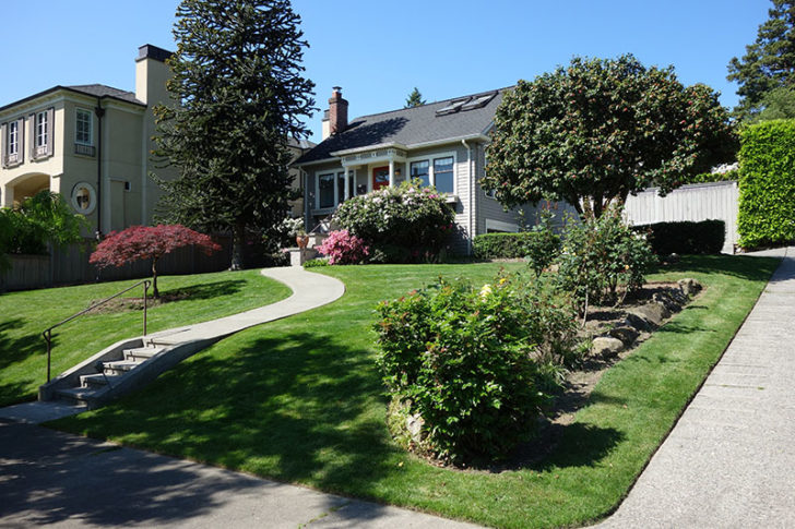
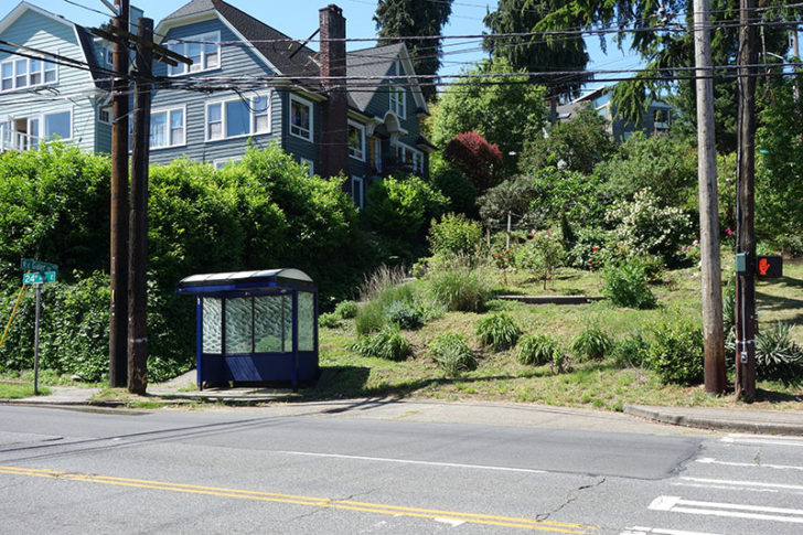
After only a couple more blocks we reach the intersection of E Galer St and E Madison St. Madison is the main street that connects Madison Park and the adjacent community of Washington Park to Capitol Hill and Downtown. Nearby is the best Starbucks in the city. Don’t wait in line for an hour in Pike Place. Rumor has it that Howard Schultz lives nearby and visits this location on his way to work.
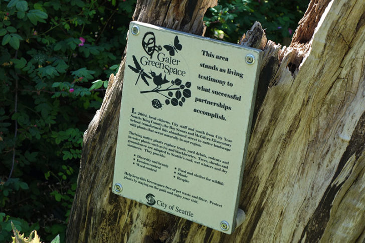
Galer St cuts across Madison to create two small triangle parks, and on the other end it forms a small dirt path through the formally named Galer Green Space.
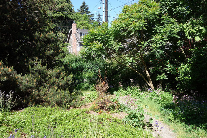
This happens to be directly behind the Russian Consulate.
After a few more blocks uphill we began going down into Washington Park. This neighborhood is busier than Madison Park because it also connects to the Washington Park Arboretum, whereas Madison Park has almost no other outlet.
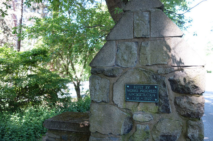
Built by the Works Progress Administration, the Arboretum a huge park near UW where you can go jogging, bicycle, or rent a canoe to paddle through the marshes. It’s one of my favorite places to go in the summer. The new light rail extension drops you off right by the stadium. Walk through the parking lot to the Waterfront Activities Center to rent a boat and row across the Montlake Cut.
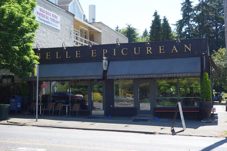
But our minds were focused on a mid-morning snack at Belle Epicurean. They have some of the best French pastries in Seattle. (There’s a second location at the Fairmont.) Be sure to visit the back patio.
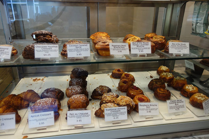
We finished our croque madames and crossed over to the Arboretum, before detouring behind the Japanese garden.
There’s a public trail, although not well maintained, that goes directly behind the Japanese garden if you want to peek inside without paying the admission fee.
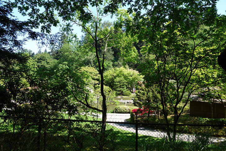
I recommend you skip the detour. It’s more trouble than it’s worth and not suitable for those who have trouble walking. We caught up with the main road and took the fork to E Interlaken Blvd.
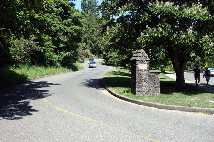
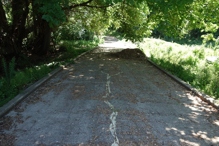
I mentioned that Madison Park is old and well maintained, but Interlaken is just old. Bridges like this one, which looks slightly precarious, aren’t uncommon around the Arboretum.
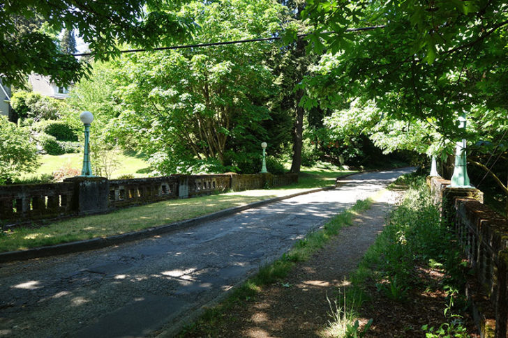
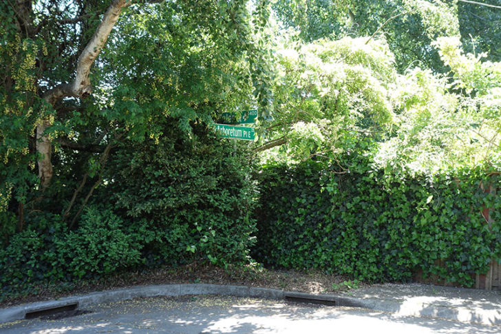
We scampered down the hill before crossing to catch up with Galer St again, the sign hidden under some wisteria.
Capitol Hill
The Seattle city clerk’s office calls this neighborhood Stevens. I’ve never heard that name — most people I know just call it Interlaken — but there are many neighborhoods most people don’t know about. The entire area is part of Capitol Hill.
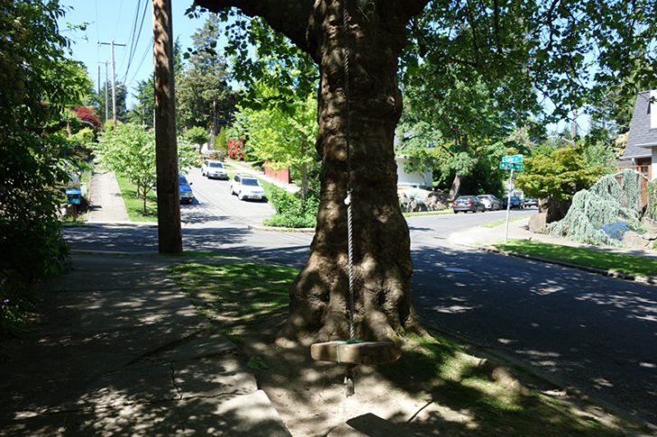
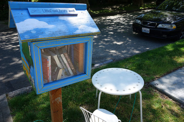
Unlike the expertly manicured lawns of Madison Park, here we found tire swings and an impromptu library in someone’s front yard.
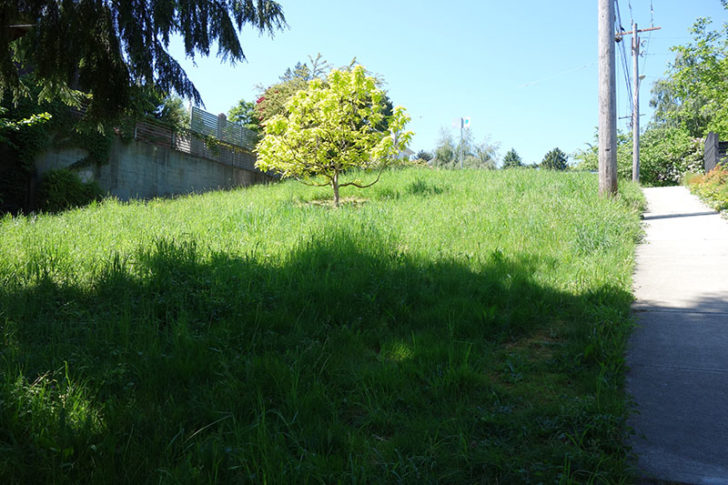
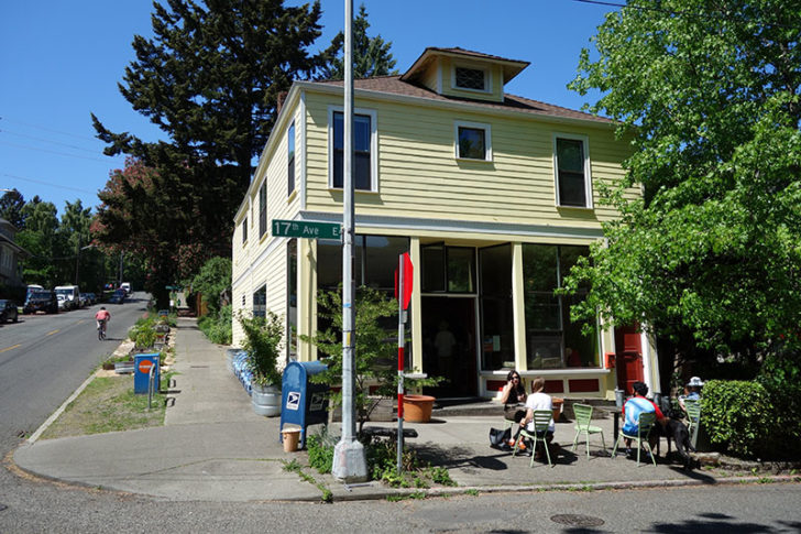
A couple blocks further, though, and we reached busy E 24th St. The stretch between E 24th St and 15th Ave E at the top of the hill was my first experience with Galer St. Megan’s friends were fond of the Volunteer Park Cafe, which is located on Galer St. It seems logical to turn here, but what I didn’t know at the time is that the street had long since reverted to nature.
After one block as a semi-organized garden it’s just grass and the occasional tree.
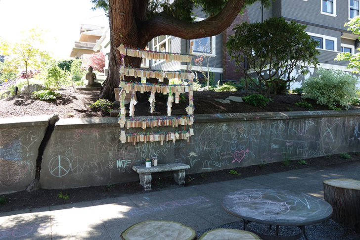
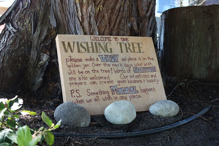
Eventually the street picks up again. That temporary interruption diverts traffic and has the benefit of helping this neighborhood retain a lot of its character. I wouldn’t necessarily want to live on the west side of Capitol Hill, but the east side is full of surprises like this wishing tree.
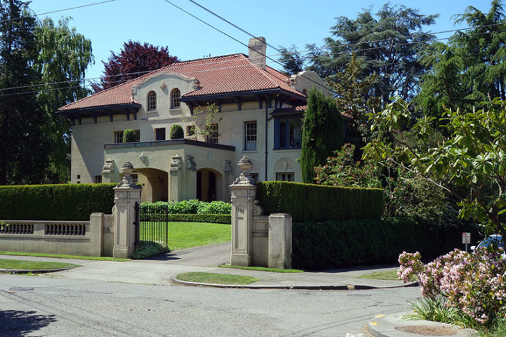
If it seems a bit hippy, there are also some large, imposing mansions along this street. Galer passes by the south entrance to Interlaken Park, a heavily wooded area that’s more suitable for hiking than pushing a stroller.
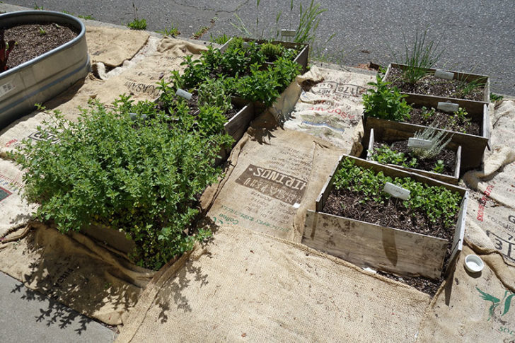
Of course, there’s Volunteer Park Cafe, too. If you didn’t stop for a bite earlier, go here for breakfast or lunch. They grow some of their own produce right on the sidewalk.
At the top of the hill is Volunteer Park itself. This massive park was named to commemorate the volunteers of the Spanish-American War. The Seattle Art Museum has its Asian art annex here (admission to the SAM downtown gets you in for free), and there are several fields and a reservoir, too. Between the reservoir and the Asian Art Museum is the Black Sun sculpture by Isamu Noguchi, which inspired the song “Black Hole Sun” by Soundgarden.
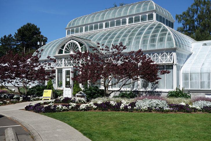
Galer St stops at the entrance the park, but if it were to continue, it would run directly behind the Conservatory, which separates Volunteer Park from the Lake View Cemetery. The cemetery has its own notable spots, including the grave of Bruce Lee.
But if you have time, my recommendation is to visit the water tower. It has free admission and offers panoramic views of Seattle. Yes, you have to look through the trees a bit, but it was the original Space Needle. We passed since there was a big concert and food truck festival taking place, instead continuing down a path to where Galer Street reappears for two blocks on the other side.
If you think Capitol Hill is the birthplace of grunge, head to the north end. It wouldn’t surprise me to learn that some of these houses still have stables.
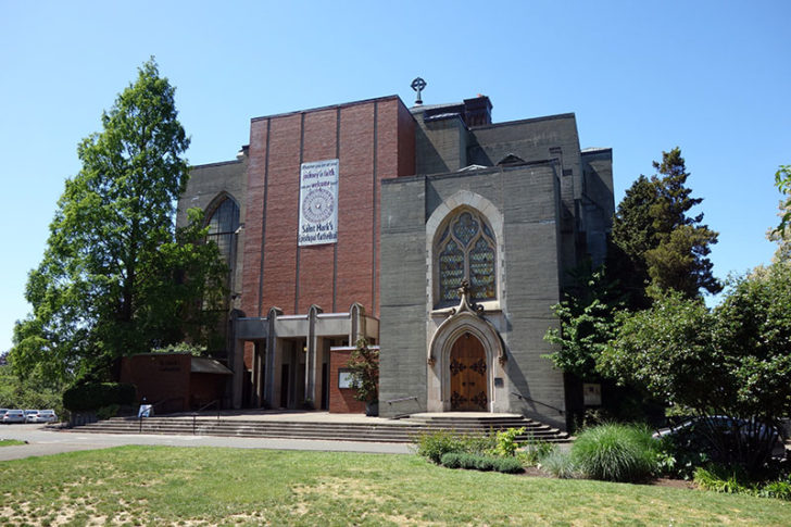
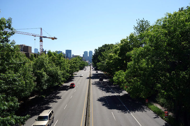
Galer runs for two blocks and dead ends at St. Mark’s Episcopal Cathedral, a brick and concrete box that you’ve probably seen from the other side of Lake Union. I had been prepared to rent another Car2Go at this point, since there’s no convenient path down to the other side of Interstate 5.
Or is there? What I didn’t know is that the St. Mark’s greenbelt runs down the back side.
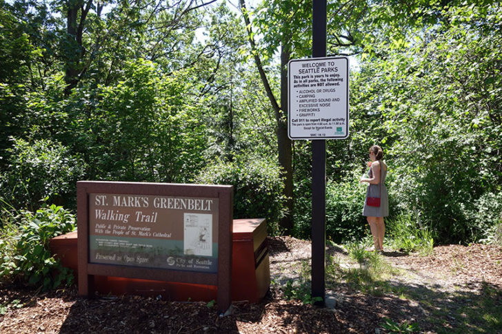
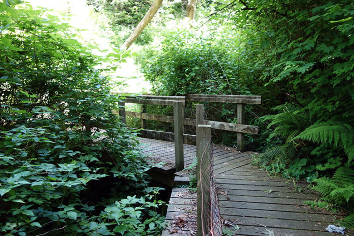
Full disclosure: I do not recommend you walk through the St. Mark’s greenbelt.
Although technically maintained by Seattle Parks, the trail is overgrown in many places, there is trash strewn about, and we passed at least one homeless encampment. Fortunately that last bit was near the bottom of the hill. We heard a voice yell “get out” and were happy to comply.
Megan lost a lot of faith in my navigation skills after passing through the greenbelt. In my defense, it wasn’t my idea for her to wear flip flops.
Lake Union
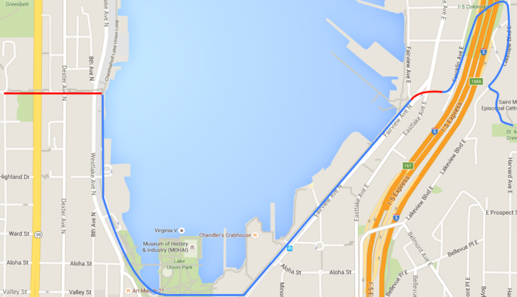
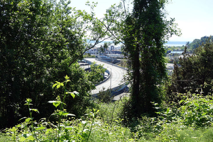
Having survived our trek through St. Mark’s greenbelt, we still needed to get to the other side of the interstate. Fortunately I remembered the I-5 Colonnade, a public park built for riding mountain bicycles between the columns that support the overpasses above. Megan was not very trusting but had few other options.
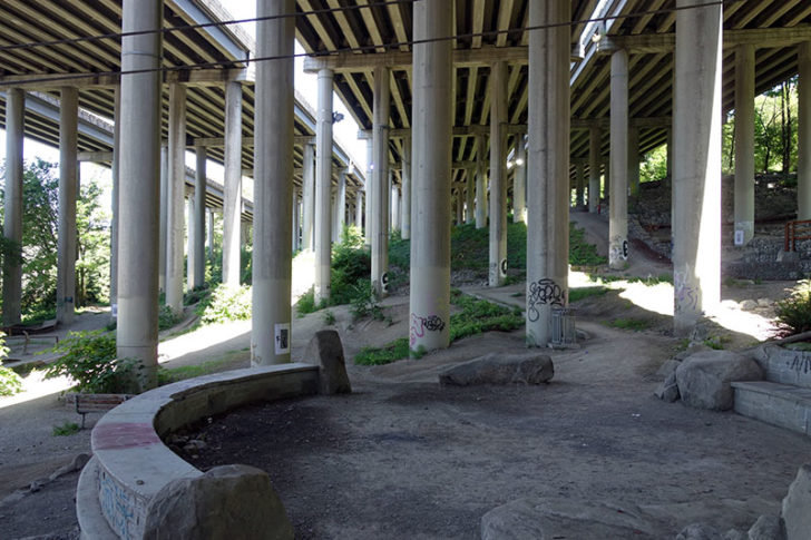
It was actually a pretty pleasant space. No encampments that I could see, and there’s plenty of visibility if you’re worried about someone sneaking up on you. There are artificial lights to illuminate the park at night.
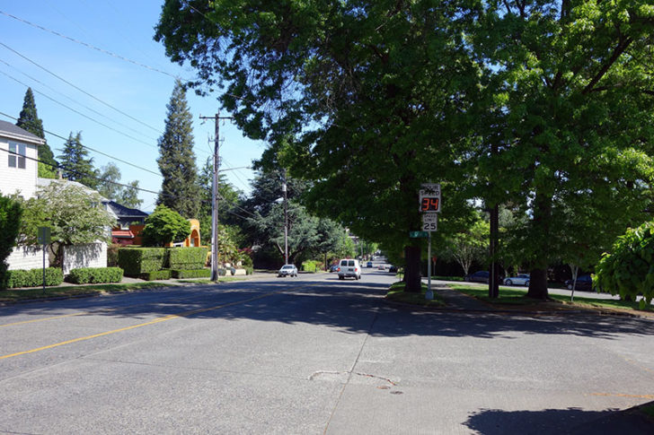
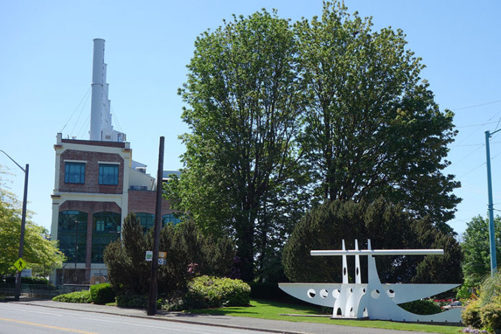
We finally caught up with Galer Street again at a substation operated by King County Metro. But after another two blocks it terminated at the intersection of Fairview Ave N and Eastlake Ave E. This is not only a key junction for traffic heading south into downtown and South Lake Union but also the site of a former steam plant, which was reconditioned as the headquarters of ZymoGenetics.
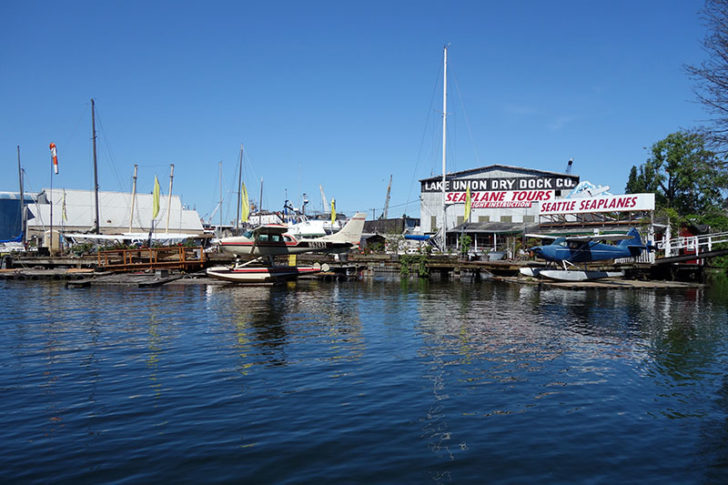
Now we had water to deal with. Of course, we could always fly across Lake Union. Seattle Seaplanes is on the end of Galer Street and offers lessons and guided tours for about $100.
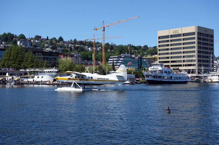
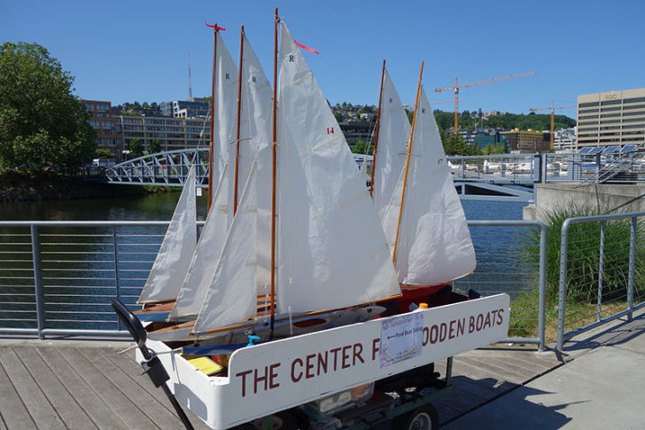
We just walked around Lake Union’s south shore to Kenmore Air on the other side, which operates regularly scheduled flights around the Puget Sound. The Museum of History and Industry (MOHAI) and Center for Wooden Boats are also located at South Lake Union Park. In between Argosy tour boats and seaplane landings, small fleets of kayaks and paddle boards would pull out from the beach and scurry across the lake.
On a nice day, the Center will have its own fleet of toy sailboats available to play with in the reflecting pool — free of charge.
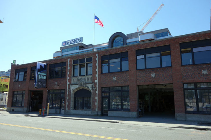
Walking back up the other side we passed the new PEMCO Insurance headquarters, known for quirky commercials that feature “Northwest profiles.”
Megan pointed out that National Sign Corporation is located just in front of PEMCO. It’s the last neon sign manufacturer in Seattle. Come to think of it, Lake Union really deserves its own walking tour. The entire circuit is about six miles if you want to do that another day.
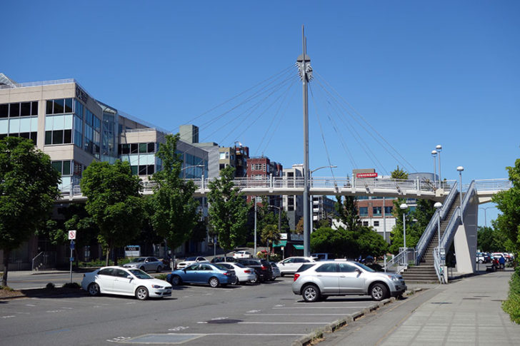
Our ultimate destination was this pedestrian bridge. Galer Street is actually the only pedestrian bridge to cross over Westlake Ave and Aurora Ave (south of Fremont). We were finally back on track.
Queen Anne
As we crossed Aurora, we entered Queen Anne. It’s an upscale neighborhood similar to Madison Park where we started, although much more accessible to downtown and with views of Elliott Bay. There are several good restaurants along Queen Anne Ave if you want to avoid the crowds of Capitol Hill. One of my favorites, Mezcaleria Oaxaca, has locations in both neighborhoods.
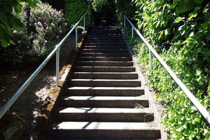
Unlike the random vegetation growing on Galer Street in Capitol Hill, the stairs here are well maintained and have railings. It was still an effort after all the previous walking and climbing we’d done.
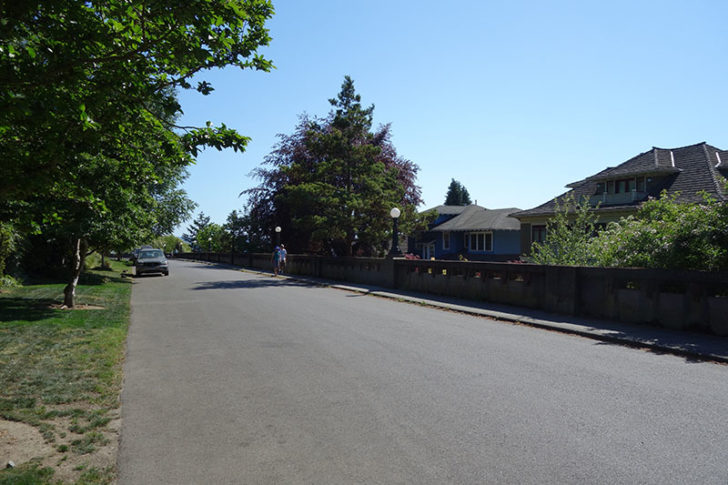
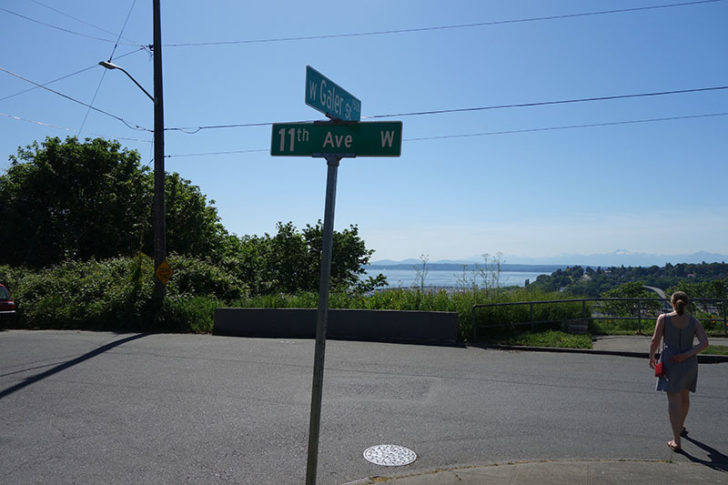
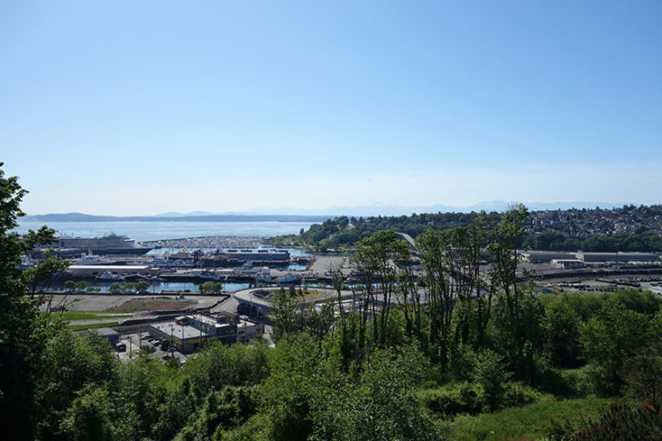
We took a break halfway up to visit Bhy Kracke Park. It’s one block from where Galer Street crosses Bigelow Ave. Look for Comstock Place on the left. This park offers great views of Seattle, and it’s rare to see more than two other people there even on weekends. Compare that to the incredible crowds at the more well-known Kerry Park on Highland Ave.
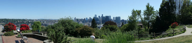
The one downside is that Bhy Kracke doesn’t have the same view of Elliott Bay that Kerry Park has, but it is an excellent place for a quiet picnic. We spent half an hour before returning to continue our climb up Queen Anne hill, finally reaching the top.
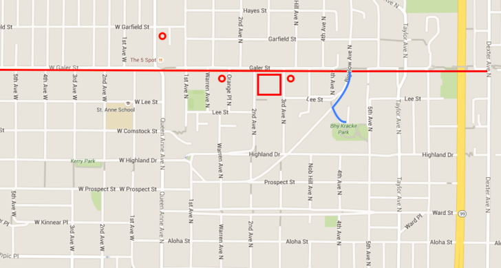
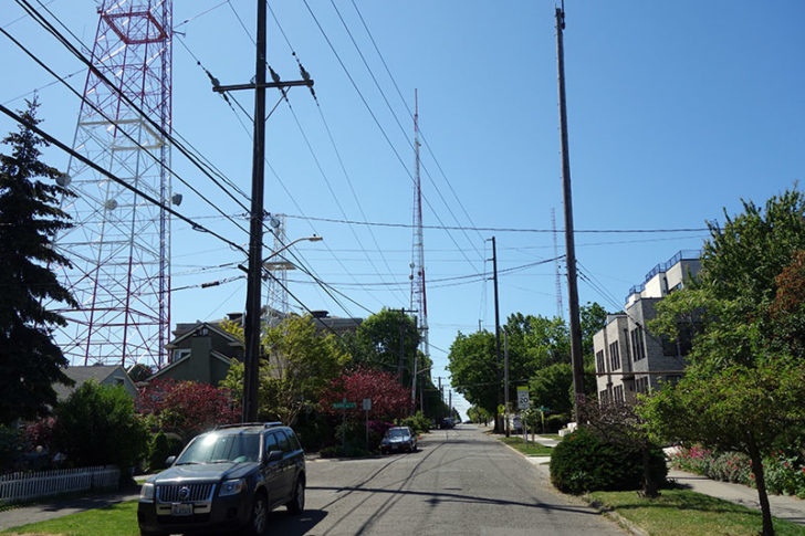
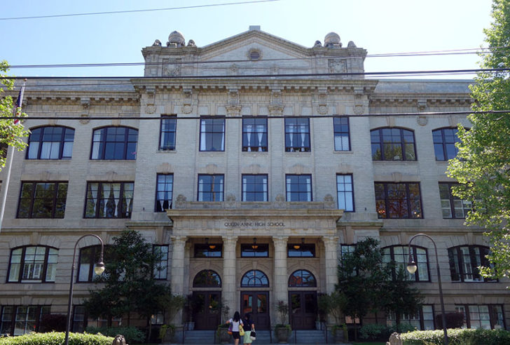
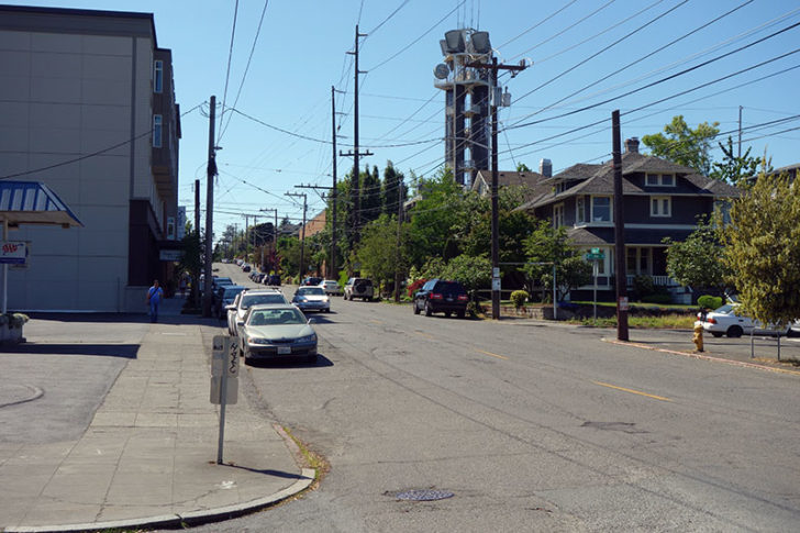
From other parts of Seattle, you might recognize Queen Anne because of the three massive television antennas. These all run along or very near to Galer Street. The stately Queen Anne High School is also visible from downtown, though it has since been converted to condominiums. I’ve marked these landmarks on the map with circles and a large rectangle.
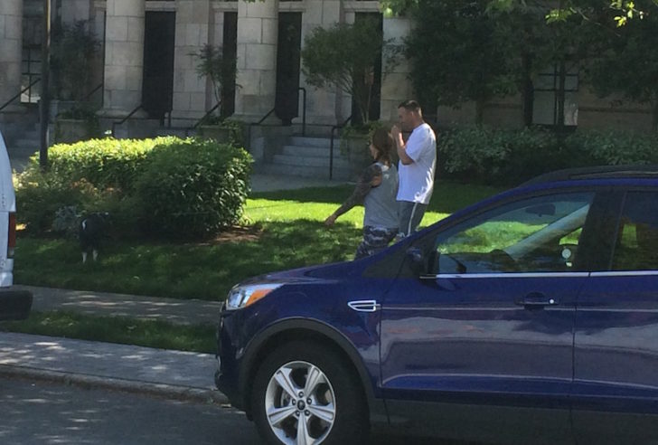
John Hay Elementary School still operates on the opposite side of the street. We noticed a few odd signs banning pets, including dogs, cats, and …potbellied pigs.
Well of course they’d have to ban pigs in Seattle. It wouldn’t surprise me to see someone with a pet pig here. If not expressly forbidden someone would try to bring it on school grounds. But Megan and I still wondered exactly how common this problem is.
Very common as it turns out. Just as we walked away from the sign we heard some loud snorts behind us as a guy walked his pig back to his condo at the Queen Anne High School. It was the size of an average dog, running quickly, and rooting through the bushes. No wonder they ban pigs at school!
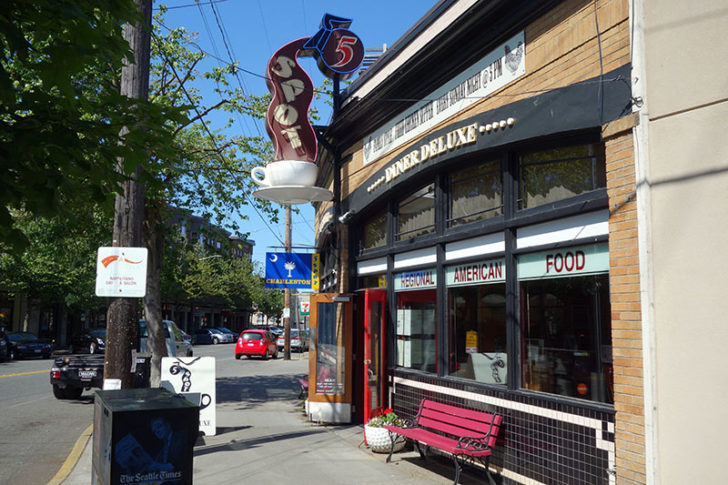
A few blocks later it was time to start heading down. The Galer Crown is the widest staircase on this street and descends to Queen Anne Ave, directly by the 5 Spot cafe. This restaurant’s menu changes several times each year to match a different global cuisine — currently Charleston. I also recommend the all-you-can-eat Sunday Fried Chicken Dinner. We settled for beer and nachos.
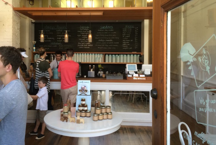
Galer Street widens to a major thoroughfare running across the south end of Upper Queen Anne. Several popular Seattle chains are on this road, including Molly Moon’s ice cream, Top Pot doughnuts, Via Tribunali pizza, and Caffe Fiore coffee.
You can also see more large antenna towers.
And more old schools converted to condominiums.
But eventually things started to head downhill. Figuratively speaking, of course. 😉 More stairs took us gradually down Queen Anne to one of my favorite areas.
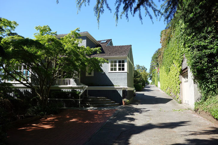
Here many houses don’t have front doors on an actual paved road. Instead they open directly onto the pedestrian path that Galer Street becomes. Rather than overgrown bushes or a simple concrete stairway there are flowers and gardens. Many still have vehicle access via perpendicular alleys.
Several of the streets have railings and lamps, crisscrossing each other as some head uphill and others downhill. This area is near 8th Ave.
But all good things come to an end. More steep stairs heading down, down, down….
Interbay
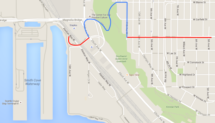
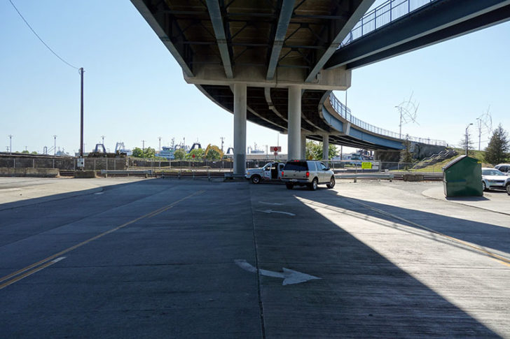
Eventually we reached the very end of Galer Street on Queen Anne hill and needed to find a way down. There was no Car2Go for several blocks, and it would have been a 10 minute wait for Uber.
We could see the overpass below, where Galer Street picked up again.
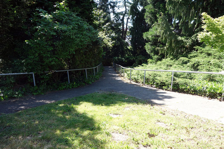
Ultimately I decided to walk two blocks north to Blaine Street and walk through the Southwest Queen Anne Greenbelt. After her experience at St. Mark’s, Megan took some convincing. But the broad, paved access road at the top of the hill won her over.
Of course, it didn’t stay that way for long. It actually wasn’t that bad, and the few other people we passed just appeared to be local residents.
But when we finally reached the bottom of the hill, Megan refused to go any further. Not one step. She turned right to wait for me at a nearby Whole Foods, and I turned left to find the overpass.
Unfortunately the overpass does not have a pedestrian sidewalk along the entire length. The best I could do is take the stairs up to walk the western half. There’s also a sign for Galer Street marking the dead end drive underneath.
Not a particularly impressive finale for a journey that started so positively. But then I don’t think you could find two neighborhoods more different than Interbay and Madison Park. I snapped my last photo and headed back to find my wife.
(On the other hand, cross over those railroad tracks to reach the north end of the Elliott Bay Trail. Head south and it merges with Myrtle Edwards Park, then the Olympic Sculpture Park, and then the downtown waterfront. Why does your urban trek need to stop? You could walk the whole way to the ferry terminal and visit Bainbridge Island!)
Epilogue
Now, technically I didn’t complete the entire length of Galer Street. My wife was about ready to kill me after reaching Interbay and already marched off to buy some whisky. (No joke.) But it’s also my own fault for not noticing that Galer Street continues a very short distance into Magnolia on the other side of the port. The entire premise of this journey was to thoroughly explore an elusive street.
Galer runs for three blocks by the Ursula Judkins Viewpoint, stops, and then begins again at the bottom of the hill for another block by the 32nd Ave W Park. I’m not sure that these are “worthy” attractions. Then again, we didn’t expect to see half the things we came across during our walk along the majority of Galer Street.
The Admiral’s House is one place of possible interest. Though not technically on Galer, it’s where Galer would be. I’m surprised my wife and I didn’t consider it as an event space when planning our wedding.
Ultimately that’s the point. After nine years in Seattle I’m still exploring and finding new favorite places, even without straying far from the core neighborhoods. There are probably similar opportunities in your hometown to take your own urban adventure next weekend. Enjoy the journey!